The Great Divide Basin is a large (approximately 10,000 km2) sedimentary basin in SW Wyoming with several thousand feet of partially exposed fossil-bearing sediments dating from the Cretaceous to the Eocene Epochs of Earth history. The GDB straddles the Continental Divide and is nearly unique in North America in being an “internal drainage basin” with no outflow of water via streams or rivers into any external drainages. As the Rocky Mountains were uplifted and the Paleocene Epoch turned into the Eocene (at roughly 56 mya), the GDB encompassed a large lake called Gosiute: the fossils that we search for are the remains of animals and plants that lived along the shore of Lake Gosiute and along stream channels that fed the lake. Since 1994 we have been studying the geology and vertebrate paleontology of Paleocene and Eocene deposits in the GDB, hoping to better understand the effects of global warming on the mammalian faunas of the American West, and to flesh out the picture of mammalian evolution (and in particular, primate evolution) in this hitherto little studied sedimentary basin. In particular we are interested in a number of related questions of paleobiological interest:
- how did climate change during the Eocene affect mammalian and primate evolution?
- how does the record of mammalian evolution in the GDB compare to that established in other basins of the American West?
- why are the faunas of different sedimentary basins in the region characterized by subtly different faunal assemblages, even when of similar age?
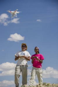
Much of our research has been directed towards developing a new, interdisciplinary kind of paleontology that we refer to as Geospatial Paleontology. Working closely with Jay Emerson of Western Michigan University’s Geography Department and Glenn Conroy of Washington University’s Department of Anthropology, we have applied the tools, datasets, and analytical methods of the Geographic Information Sciences (GIScience) to the search for and the analysis of fossil localities. We have pioneered the use of unmanned aerial vehicles or drones in paleontological fieldwork, using photogrammetry to create 3-dimensional models of fossil localities and regions. Using satellite imagery, we have developed and ground-truthed predictive models based on machine learning and artificial intelligence approaches that can increase the likelihood for finding new fossil localities in the GDB. We have also demonstrated that these methods can be applied in other locations and in other paleontological settings, notably in Miocene sediments of Gorongosa National Park in Mozambique.